Daikiretto
The most exposed marked ridge in the Japanese Alps: steel cables, ladders and drops at over 3,000 metres. Similar to Orla Perć in the Tatras, but stretching across five 3,000-metre peaks. My four-day traverse from Nakabusa Onsen to Kamikochi.
Go if you
- have no problem with steel cables, ladders and exposure
- want to cross five 3,000-metre peaks on one ridge
- can help yourself with your hands even with a heavy pack
Skip it if you
- are afraid of heights and drops beneath your feet
- want to go on a long weekend and do not want to wait in queues on ladders
- if lots of rain is forecast (wait for better weather 🙂
The hardest parts
- a long rocky scramble on Daikiretto, in places only 1 km an hour
- the continuation to Nishiho hut, even more exposed than Daikiretto
- a climb of 1,700 m straight away on the first day from the forest to the ridge
How I hiked it
Nakabusa Onsen and the Tsubakuro ridge
start by the hot springsTsubakuro 2,762 mtent above 2,900 m
On Saturday the weather in the Hakuba area finally came to its senses after the rains. On the way to the start I stopped at the beautiful wooden monastery of Ariakezan and then I was driven to Nakabusa Onsen. Next to the hot springs is the official start of the route.
From Nakabusa Onsen the trail leads through dense forest and past several huts, and you climb more than 1,700 metres of elevation to the ridge. It was a long weekend, so the trails were full of local hikers. At the hut on the ridge there was a small tent town, at least fifteen tents.
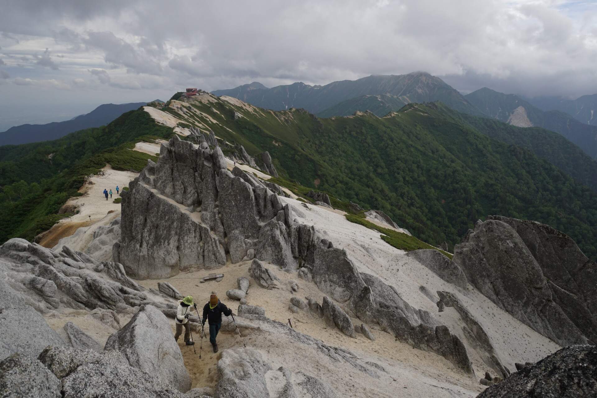
From the ridge a nice view opened to the north, so I took a short detour to Tsubakuro (2,762 m). Its ridge is made of protruding light-coloured rocks. Then I walked along the ridge south past Otenjo hut. Just before a small saddle at over 2,900 metres I found the only suitable place for a tent. The higher mountains were already covered in clouds.
Monkeys by the lakes and Jarigatake (3,180 m)
lakes below the ridgedozens of monkeys at 2,500 mJarigatake 3,180 m
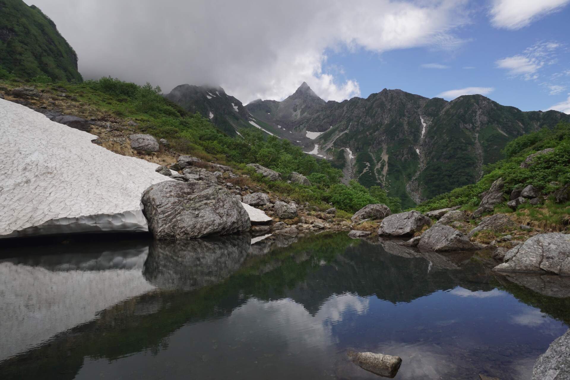
The forecast said that Jarigatake would be in clouds all day. So I came down from the ridge to small lakes and pitched my tent there before nine in the morning. Around three in the afternoon I did yoga on my sleeping mat and for a few minutes the sharp peak of Jarigatake showed itself.
What surprised me most were the monkeys. At 2,500 metres dozens of monkeys of all generations suddenly appeared, including mothers with babies on their bellies. The young slid down the snowfields and the others grazed on fresh grass.
My alarm rang at two at night under a clear sky full of stars. At 4:15 I stood on the ridge above Sessho hut and with other hikers watched the sunrise. In the distance I could see the whole ridge I had walked and the iconic Mount Fuji.
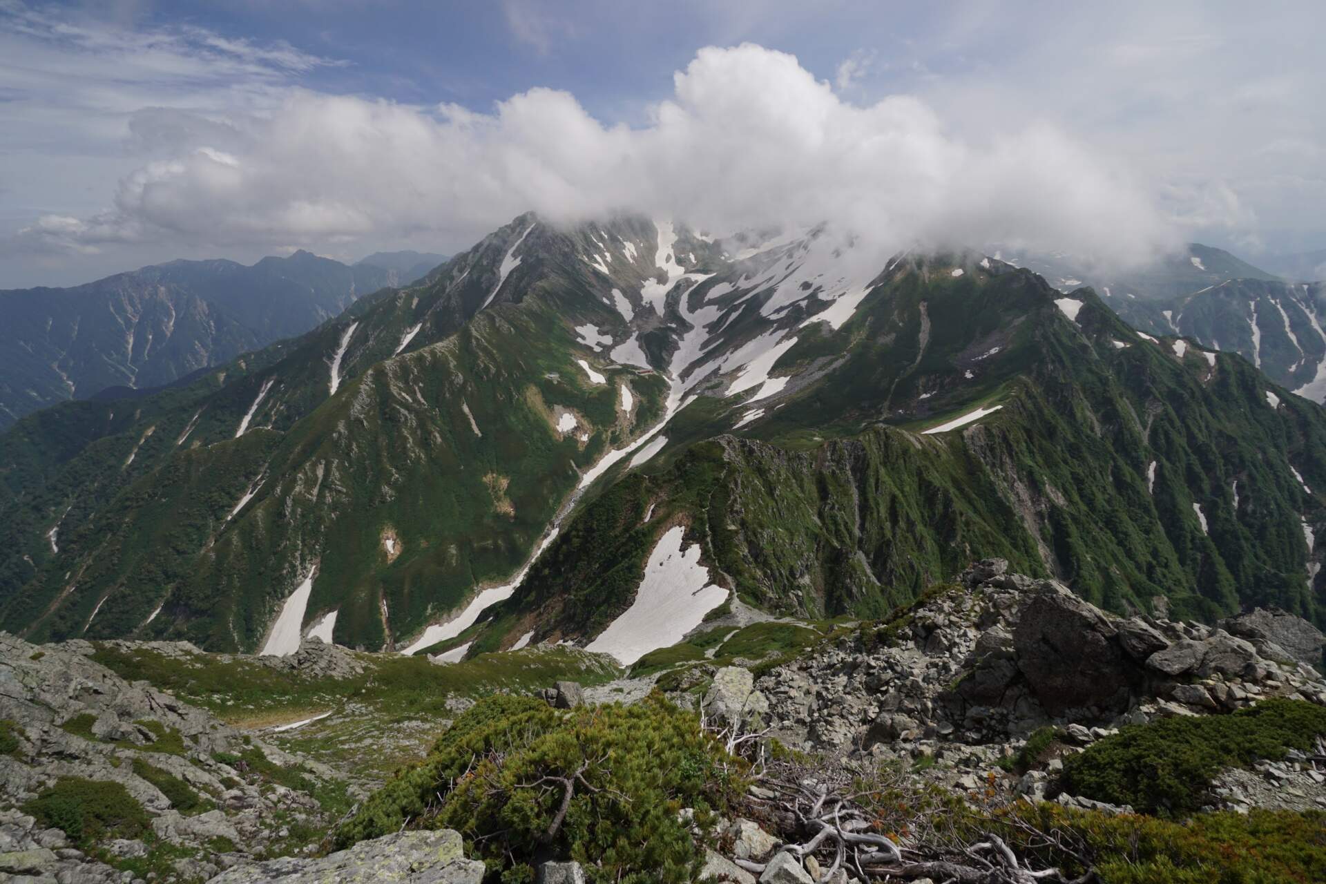
I continued to the hut on the ridge, where crowds jostled because of the long weekend. For the Jarigatake pyramid itself I had to leave my heavy pack at the hut. The whole final section is made of stretched steel cables and ladders. Because of the number of people there was literally a traffic jam. Although there are two separate routes, one for the ascent and one for the descent, I waited half an hour on the ladders. On the summit there is a small chapel and a view of Tateyama and the whole massif of the Japanese Alps.
The Daikiretto ridge and a night below Oku-Hotaka
five 3,000-metre peaksscrambling with handsOku-Hotaka 3,190 m
From the summit of Jarigatake I turned straight south onto the dreaded Daikiretto ridge. It leads over five 3,000-metre peaks. The first metres still went along a nice trail, but soon steep rocks, steel chains and ladders above drops began.
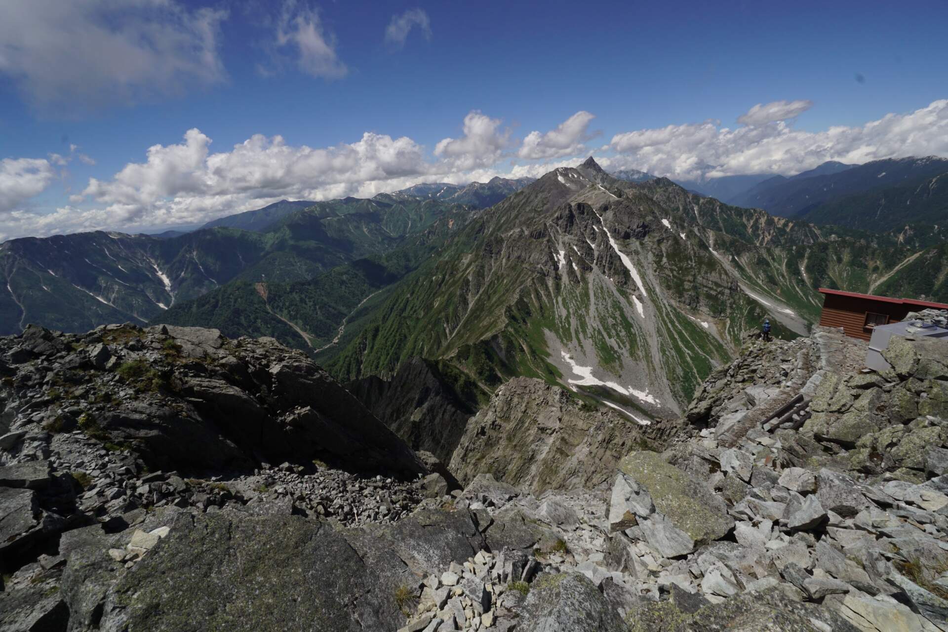
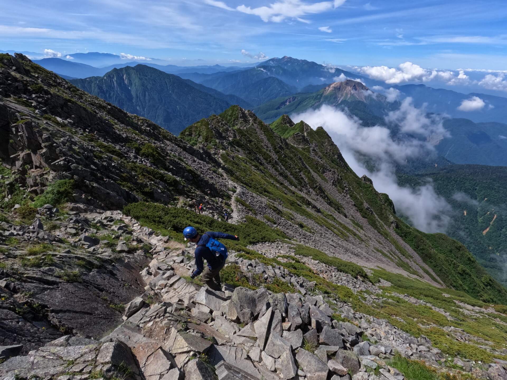
Daikiretto is a proper rocky scramble where you climb with your hands for whole kilometres. At one of the huts I stopped for lunch, traditional Japanese curry with rice, and refilled my water.
Around five in the afternoon, after a whole day of climbing, I reached Oku-Hotaka (3,190 m). After a sunny day the mountain was starting to wrap itself in clouds. Just a few metres below the summit there was a beautiful flat spot on the rocks. It had not been windy during the day and the night was supposed to be calm, so I pitched my tent right below the summit and watched the sunset.
The ridge to Nishiho hut and the descent to Kamikochi
sunrise at 3,190 mmore exposed than DaikirettoKamikochi
I got up at four in the morning and while packing the tent I saw another sunrise at an altitude of 3,190 metres. I faced a choice: go down the easy trail, or continue along the ridge to Nishiho hut, which is considered even more exposed and technically harder than Daikiretto itself.
I decided to continue along the ridge. With a heavy pack it was a proper physical and mental grind. Climbing up and down over several rocky peaks brought sections where the cables and ladders were even steeper. Fortunately the rocks had good handholds. For part of the route I teamed up with a Japanese couple and together we overtook other groups of climbers.
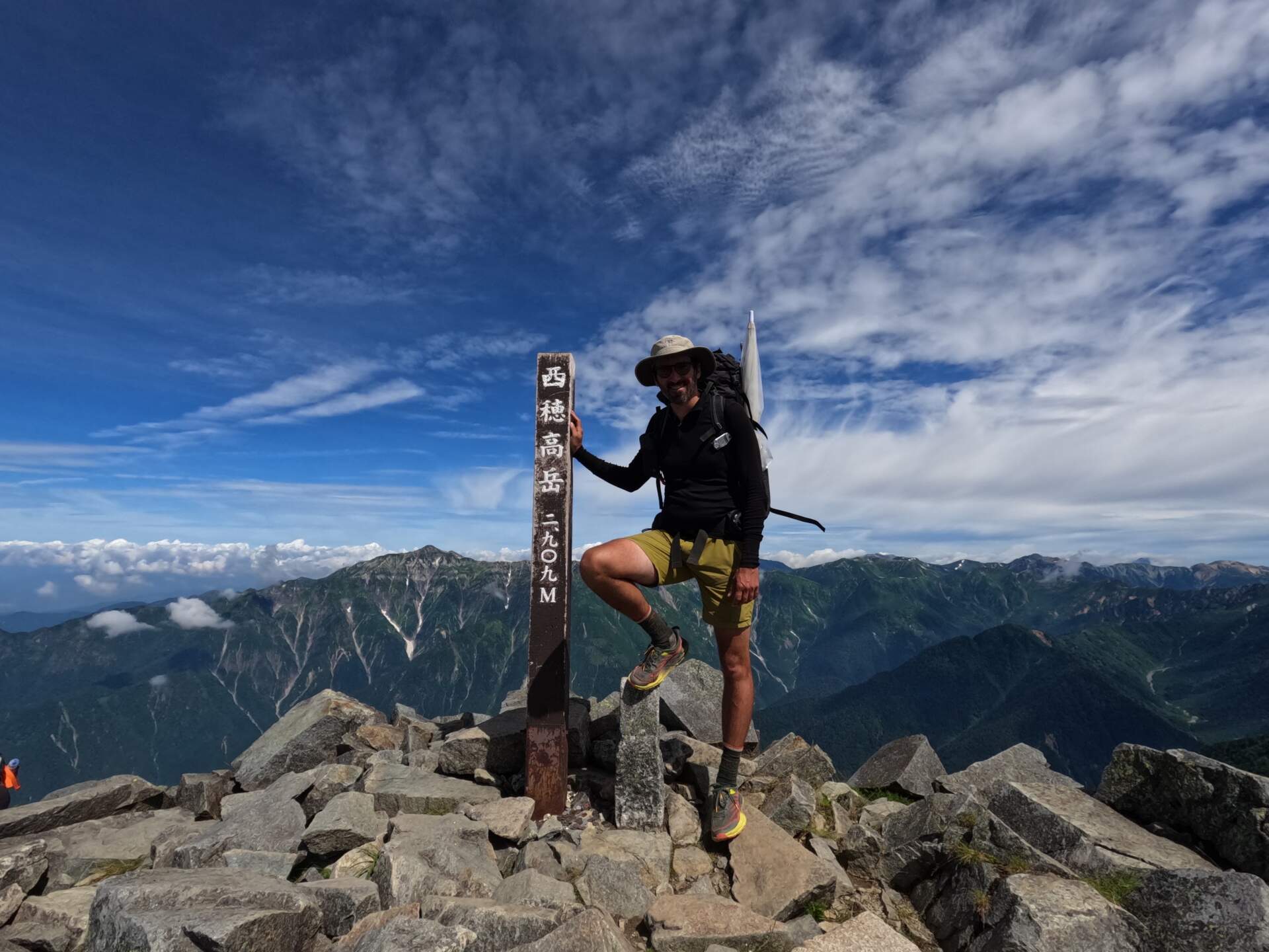
The last descent to Nishiho hut was already without climbing protection, so I sped up towards a well-deserved warm lunch and refilled my water.
From Nishiho hut a steep descent through forest leads straight into the Kamikochi valley. It welcomed me with a completely different world: a lively tourist centre with a clear river and crowds of visitors. At the local post office I even handed in a damaged sleeping mat for a warranty claim with the Japanese distributor. After difficult days on rocks and chains, that ended my traverse of the technical heart of the Japanese Alps.
My route on the map
A recording of my trip (38.8 km according to Outdooractive). You can zoom and pan the map and switch to another base layer (topo, USGS, satellite, OpenStreetMap).
Elevation profile
Highest point of the recording: 3,158 m a.s.l. (GPS elevations, approximate; Oku-Hotaka is officially 3,190 m). According to Outdooractive the route is 38.8 km with 4,139 m of ascent and 4,090 m of descent.
Best season and conditions
The ideal period
The main season in the Northern Alps lasts from mid-July to mid-October. The snow is gone then and all the huts are open. The best weather is usually from the end of July to the beginning of September. The rainy season starts at the end of June and lasts about a month. From October to June there is snow on the ridge and you cannot go there without crampons and an ice axe.
My trip
I went from 15 to 18 July 2023, so at the end of the rainy season.
My gear on the hike
Part of my gear, with weights 5,354 g
| Backpack | HMG Junction 3400 ↗ (L, with two shoulder pockets) | 1,120 g |
|---|---|---|
| Tent and pegs | Gossamer Gear The Two ↗ (with 12 HMG pegs) | 812 g |
| Sleeping mat | Thermarest NeoAir XTherm ↗ | 435 g |
| Sleeping bag | Katabatic Flex 22 ↗ | 644 g |
| Base layer | Devold Duo Active 205 ↗ | 274 g |
| Jacket | Bergans Rabot V2 3L | 356 g |
| Shoes | La Sportiva Wildcat | 683 g |
| Socks | Darn Tough Hike/Trek (merino) | 94 g |
| Camera | Sony a6300 + 10–18 mm + 50 mm | 936 g |
Thank you to the partners for the gear that keeps me comfortable on hikes. Links with an arrow lead to their shop.